National parks of Croatia

Table of Contents
We guess you've already heard Croatia has extraordinary beautiful nature. But did you know its small surface hides 8 National Parks (and 11 Nature Parks!)?
Four of those eight National Parks can be reached (only) by sea, and those are the ones we want to highlight here.
Let's start from the north part of Croatian coast and work our way down to the south.
Brijuni
The Brijuni are a group of fourteen small islands situated in front of Istria coast. Famous for their beauty, these islands are also a holiday resort since the beginning of the 20th century. In that period Brijuni was the meeting point for European and world elite.
After World War II the Brijuni became part of Yugoslavia, and President Marshal Josip Broz Tito made the Brijuni Islands his personal State Summer Residence. Almost 100 foreign heads of state visited Tito on his islands, along with celebrities including Elizabeth Taylor, Richard Burton, Sophia Loren, Carlo Ponti, and Gina Lollobrigida. Tito died in 1980, and by 1983 the islands were declared a National Park of Yugoslavia and later National Park of Croatia.
In 1991 Croatia gained independence and made the Brijuni Islands an International Conference Centre. Four hotels on Veliki Brijun Island were re-opened, as well as a Safari Park, which holds animals given to Tito, such as two Indian elephants donated by Indira Gandhi - Sony and Lanka. Unfortunately, Sony died in 2010. There are other exotic animals here, all gifts from foreign diplomats. For example, you can see zebra, nilgai and waterbuck.
Apart from natural beauty and Safari Park, history lovers will enjoy the Roman ruins. The Brijuni was a sort of holiday resort even in the Roman period. The famous historical site is Roman villa Rustica in Verige Bay which had residential and economic buildings.
Brijuni is a small archipelago, with an area of around 7km2, but it is rich in history and culture. There, you can visit over 100 sites and buildings of archaeological and cultural value. Also, you'll find over 200 dinosaur footprints at four spots on Veliki Brijun!
{{gallery14}}
Kornati
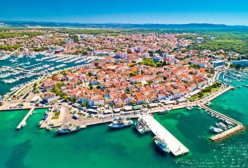
Kornati National Park is a true nautical paradise! What else can you call these 89 islands, islets and reefs situated at your fingertips from our base in Biograd?
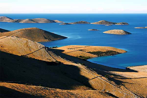
The Kornati archipelago covers the area of about 320 km2 and includes around 150 land units, located either permanently or frequently above the sea.
Because of their exceptional landscape beauty, interesting geomorphology, as well as because of rich submarine eco-system, the islands were made a national park in 1980. It’s interesting to know that all the islands in Kornati archipelago are private property, mostly of people living on the nearby island of Murter.
The landscape here is famous for being „Mars-like“ because of the stony ground. But don't think there is no life on the Kornati; various kinds of small animals live here, as well as different plants (for example orchids!). The sea life is a story of its own; rich with species and it's also protected. The biggest part of this National Park is actually the sea, not land.
Important tips:
- ZONES OF STRICT PROTECTION:
The island of Purara and the area around it are under special protection, visitors and boats are not allowed to go there. They are constantly monitored by scientists who study life in the sea and on the islands. Klint and Volić reefs, Mrtenjak islet, Kolobučar islet, Small Obručan and Great Obručan islets are also under strict protection.
- SAILING, ANCHORING AND DOCKING:
Sailing is allowed in the whole of the Kornati National Park except in the zones of strict protection. Anchoring and overnighting is permitted in the following bays and coves: Stiniva, Statival, Lupeška, Tomasovac - Suha punta, Šipnate, Lučica, Kravljačica, Strižnja, Vruje, Gujak, Opat, Smokica, Ravni Žakan, Lavsa, Piškera - Vela Panitula, Anica on Levrnaka, Podbižanj, and Koromašna.
- SWIMMING AND DIVING:
Swimming is allowed in the whole area of the Kornati National Park except in the zones of strict protection. Autonomous diving is allowed only in organised groups, with a licence for autonomous diving in the Kornati National Park obtained in advance.
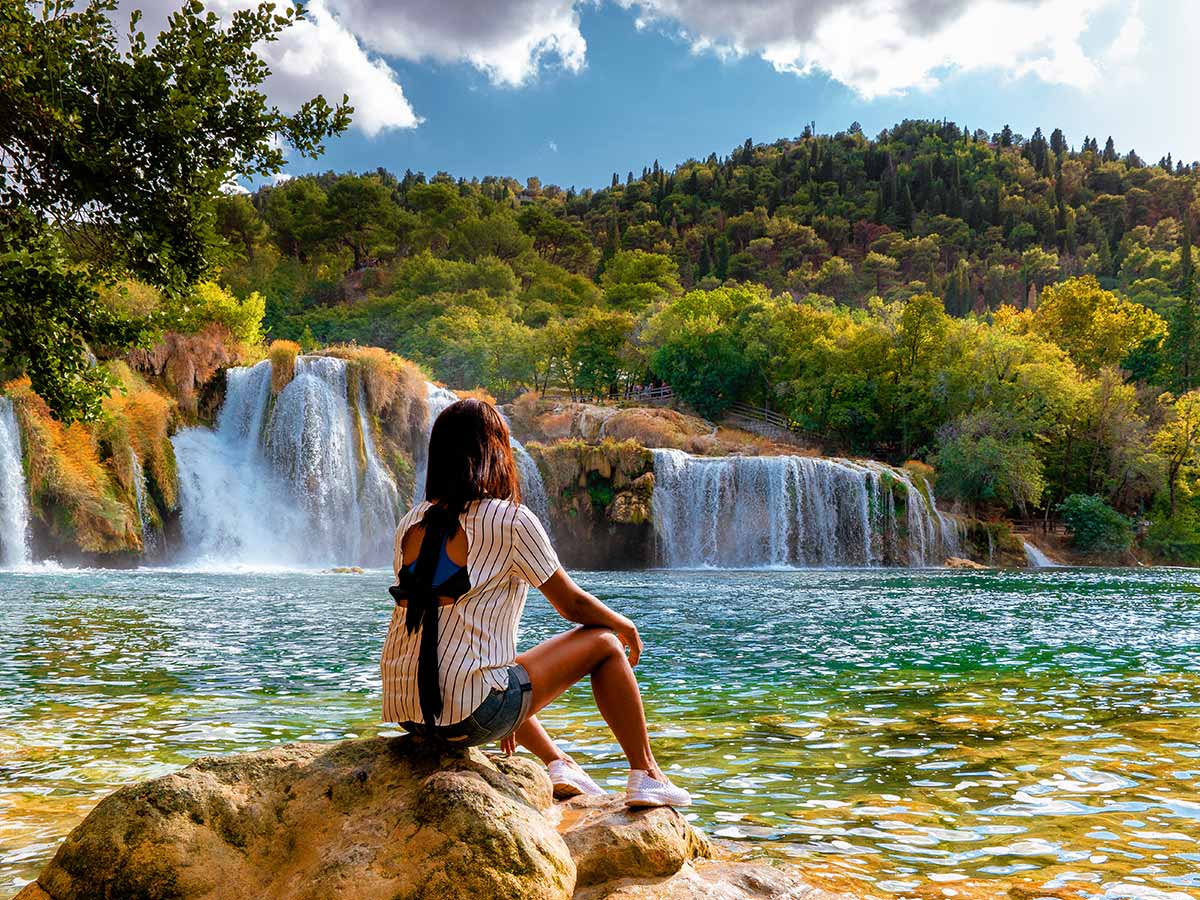
Krka
This National Park protects the Krka river and its surroundings. The estuary of Krka is just a few kilometres from Šibenik, and it offers you a very nice scenery for sailing through the Krka canyon up to the town of Skradin and the entrance point for the National Park.
For thousands of years, Krka has hollowed out its path through rock and has created its remarkable waterfalls with travertine cascades which are extremely rare in the world. In the year 1985 its remarkable karst beauty was recognized and placed under protection proclaiming the 46 kilometres of the Krka River flow a National Park.
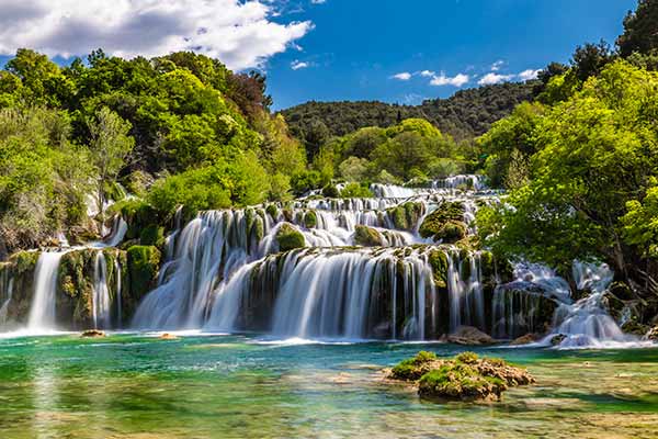
There are 8 waterfalls and 10 lakes, among which the most popular is Skradinski buk – the longest waterfall on the Krka River and one of the best known natural beauties of Croatia. It can be viewed thanks to a network of paths and bridges that enable comfortable walking.
Visovac island, with the Franciscan Monastery and the Church of Our Lady of Visovac, is one of the most important places of cultural heritage. It can be reached by the organized boat excursions from Skradinski buk, Stinica and Remetić (marked on the Krka National Park map) which includes a 30-minute tour of the island, the Franciscan monastery, church and museum.
Roški slap is made up of a 22,5 high main waterfall and numerous cascades and backwaters. The start of the barrier is built of a series of small cascades, called the necklace by the locals. Over the waterfall there is a road that dates from Roman period.
If you feel sporty and have time, the Educational Hiking Trail (Stinice – Roški slap – Oziđana pećina) is for you! The total length of the trail is 8,5 km with an altitude difference of 176 m and the average walking time is 2,5 to 3 hours. The trail is filled with educational panels and excellent viewpoints.
{{gallery15}}
Mljet
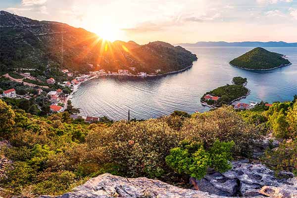
Mljet National park is the most important protected area of the south of Dalmatia. The Park covers the western part of the island, full of various Mediterranean vegetation - Mljet is considered to be the greenest Dalmatian island. The area of the Park includes two deep bays which are fittingly named, lakes: the Great Lake and the Small Lake. Their link with the sea is extremely narrow, which is why they look like lakes.
The island is also rich in cultural heritage. The most attractive monument is the complex of the Benedictine monastery form 12th century located in a small island in the middle of the Great Lake - The Islet od Saint Mary. This islet is the most visited location here and a symbol of a Park. The entire surface area of the park is extremely rich with life, numerous endemic and endangered species.
There are two villages from which the park can be entered – Polače and Pomena, and there you can buy the tickets, get the brochures and maps. Pomena is a 10-minute walk from the Small Lake and 20-minute walk from the Small bridge where you can take a boat to the Islet of Saint Mary.
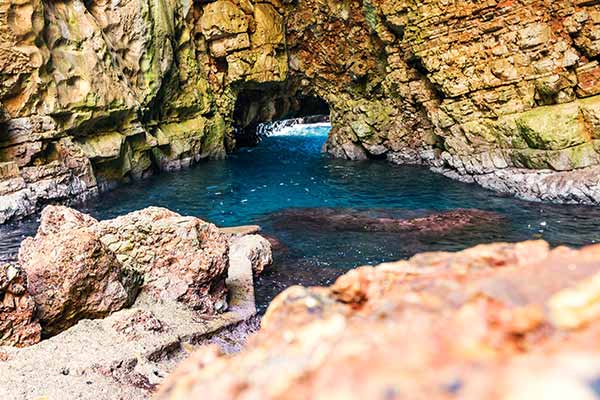
Outside of the borders of the National park, there is famous Odysseus Cave, located on the southern coast of the island. It is named after the legend of Odysseus who was allegedly shipwrecked near the cave and remained "trapped" because of the nymph Calypso, who ruled the island. The cave can be entered by sea, by swimming or by a smaller boat, the entrance is about 4-5 meters wide.
{{gallery16}}